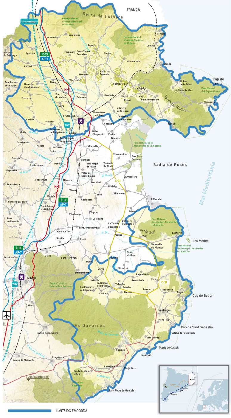
The production area of the Empordà DO, located in the far north east of Catalonia, encapsulates 55 municipalities spread across two districts. Empordà has two geographically distinct areas: Alt Empordà with 35 municipalities and Baix Empordà with 20.
The production area of Alt Empordà is in the far north east of Catalonia (stretching northwards from the city of Figueres to the French border). It is protected by the slopes of the Sierra de Rodes and the Las Alberas Mountain Ranges, starting in Cap de Creus and spreading in an arch-like form to Garrotxa d’Empordà (Albanyà).
Alt Empordà borders the Pyrenees in the north, the Mediterranean in the east and flat plains to the south.
Alt Empordà municipalities are: Agullana, Avinyonet de Puigventós, Biure, Boadella i les Escaules, Cabanes, Cadaqués, Cantallops, Capmany, Cistella, Colera, Darnius, Espolla, Figueres, Garriguella, La Jonquera, Llançà, Llers, Masarac, Mollet de Peralada, Palau-saverdera, Pau, Pedret i Marzà, Peralada, Pont de Molins, Portbou, Port de la Selva, Rabós, Roses, Sant Climent Sescebes, Selva de Mar, Terrades, Vilafant, Vilajuïga, Vilamaniscle and Vilanant.
The Baix Empordà production area borders the Montgrí Massif in the north, the Gavarres Massif in the southwest — that forms a coastal plane with the Begur Massif — and with the Mediterranean to the east.
The municipalities in Baix Empordà are: Begur, Calonge, Castell-Platja d'Aro, Forallac, Mont-ras, Palafrugell, Palamós, Palau-sator, Pals, Regencós, Torrent, Torroella de Montgrí and Vall-llobrega.